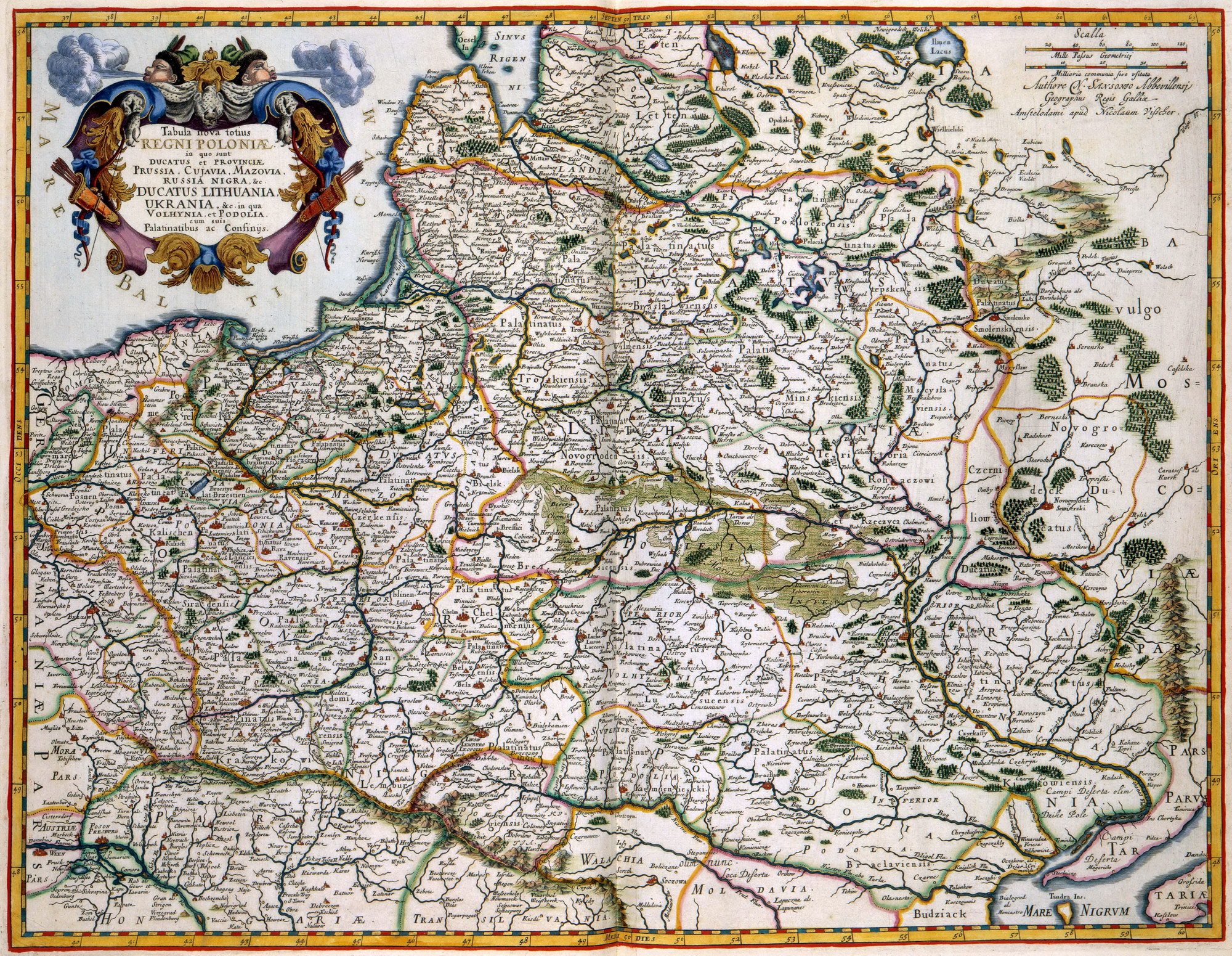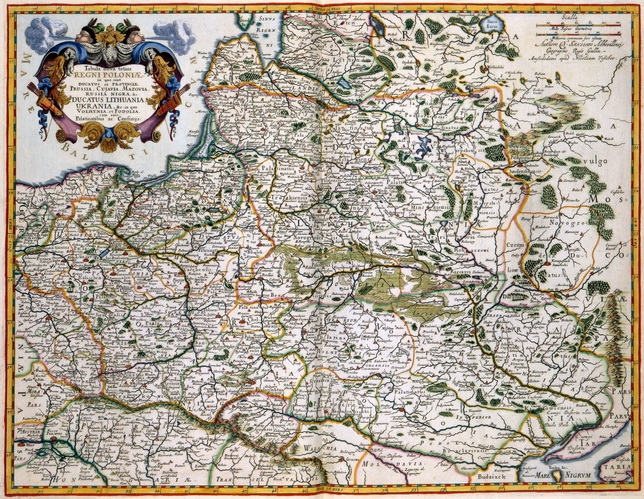
In 1655 verscheen in Parijs een grote overzichtskaart van het toenmalige koninkrijk Polen van de hand van Nicolas Sanson (1600-1667). Hoewel deze kaart niet veel meer was dan een goede compilatie van ouder kaartmateriaal, behaalde Sanson een groot commercieel succes.
Polen was vanaf het midden van de 17de eeuw verwikkeld in verschillende militaire conflicten met Zweden, Rusland en Turkije. Het verloop van de strijd werd overal in Europa nauwlettend gevolgd en er bestond dan ook grote vraag naar goede kaarten waarop de legerbewegingen konden worden gevolgd. De uitgever Nicolaas Visscher I (1618-1679) probeerde zo goed mogelijk aan die vraag te voldoen.
Hij liet de kaart van Sanson kopieren en publiceerde het resultaat als een eigen uitgave.
Name: | Tabula nova totius REGNI POLONIAE in quo sunt DUCATUS et PROVINCIAE PRUSSIA, CUJAVIA, MAZOVIA RUSSIA NIGRA &c. DUCATUS LITHUANIA UKRANIA, &c. in qua VOLHYNIA, et PODOLIA, cum suis Palatinatibus ac Confinys |
Keyword: | Visscher, Nicolaas (person) |
Year of making: | 1680 |
Maker: | auteur: Auteure N. Sansonio Abbevillensi Geographus Regis Gallia |
Source: | shelfMark: 1049B10_034 [kaart (kopergravure)] (Atlas Van der Hagen [Koninklijke Bibliotheek, Den Haag]) |
Copyright: | Koninklijke Bibliotheek, Den Haag |
Object: | image |
In 1655 a large-scale map about the kingdom of Poland was published in Paris. Its author was Nicolas Sanson (1600-1667). Though the map presented only a good compilation of maps already available, its commercial success was great.
From the middle of the 17th century, Poland was in military conflict with Sweden, Rusland and Turkey. The development of these conficts were eagerly followed in Europe.
As a consequence, detailed maps with the movements of armies became very popular. Nicolaas Visscher I (1618-1679) tried to fulfill this need of his clients. Therefore, he had the map by Sanson copied and published the result as his own. Deel: 1